
The Clarendon Way loops are the easiest way to get familiar with the route – 9 easy to moderate, family friendly walks.
We cut the 42 miles of the Clarendon Way into nine stretches and traced each of them back to the starting point, resulting in nine circular loops. You can do the entire route in nine separate walks, each between 7.5 and 15 kilometres.
If you do all of them, it’s 100.8 km which can be done over a number of weekends. Alternatively, you can just start with one and see if you like the Clarendon Way. It’s also to combine some of the loops (suggestions below).
Back to Clarendon Way overview.
Choose your next Clarendon Way loop
Discover the nine routes – use the buttons to zoom to an individual walk and click on the walker symbol for a link to the detailed description for each walk:
If you are undecided which one to pick, start in the middle with loop 5 – it’s the shortest and easiest walk in this collection. Some of the starting points can be reached by public transport, though it’s certainly easier to have your own wheels to get there.
The overall route is hilly, though the individual walks aren’t too difficult and we classified each of them as easy or moderate. We also state the total ascent, the height difference on each of the walks. 1,608 metres is the total ascent of all 9 loops.
Let us know how you are getting on with the loops and post a quick comment as a reply to this facebook post:
In case you want a paper map to plan your route or carry a map on your walk, the Clarendon Way is covered on these three OS Explorer maps *:


Combining loops
The 9 Clarendon Way loops were originally designed as half to full day walks. If you want to push yourself a little more, you can combine some of the loops and do the total 100 km in 5, 4 or even 3 days. However, some of the combined walks will be quite long.
In any case, finally reaching Salisbury does feel like a good achievement.
5 days
- Out of Winchester on to Sarum Road: 19.4 km, combining loop 1 and loop 2
- Around Beacon Hill: 19 km, combining loop 3 and loop 4
- Both sides of the River Test: 21.9 km, combining loop 5 and loop 6
- Middle Winterslow combo, 29 km, combining loop 7 and loop 8
- Easy finish in Salisbury with afternoon tea as a treat: 11.5 km, just loop 9
4 days
- Out of Winchester on to Sarum Road: 19.4 km, combining loop 1 and loop 2
- Reaching the River Test: 26.6 km, combining loop 3, loop 4 and loop 5
- On the straight Roman Road: 28.1 km, combining loop 6 and loop 7
- Winterslow-Salisbury: 26.7 km, combining loop 8 and loop 9
3 days
- Winchester – Farley Mount round: 28 km, combining loop 1, loop 2 and loop 3
- Up and down across the River Test: 32.3 km, combining loop 4, loop 5 and loop 6
- The long Clarendon Stretch to Salisbury: 40.5 km, combining loop 7, loop 8 and loop 9
Clarendon Way loop list
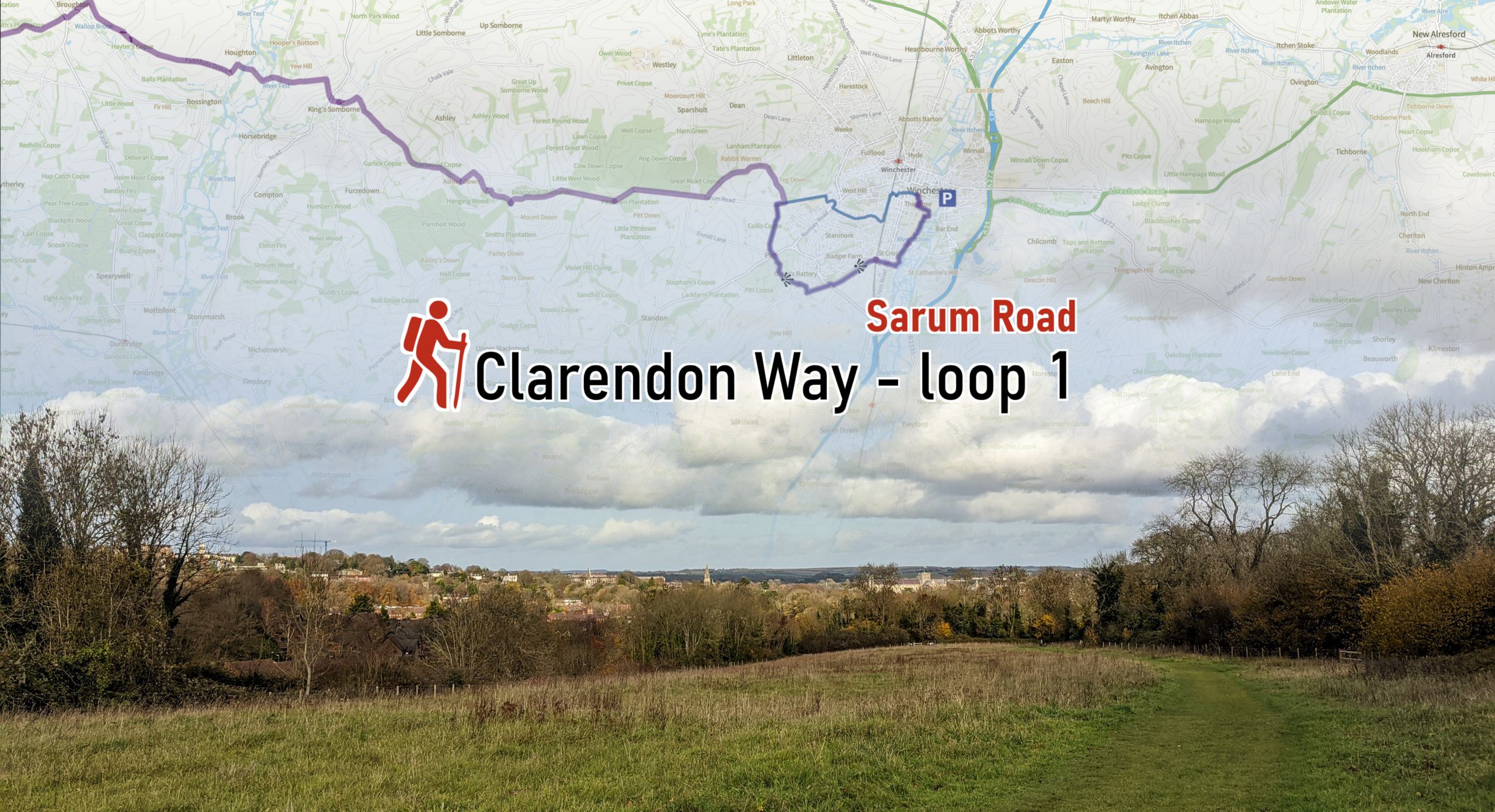
Clarendon Way loop 1 – Sarum Road
This is the beginning (or end if you walk from Salisbury to Winchester) of the Clarendon Way. We sta…
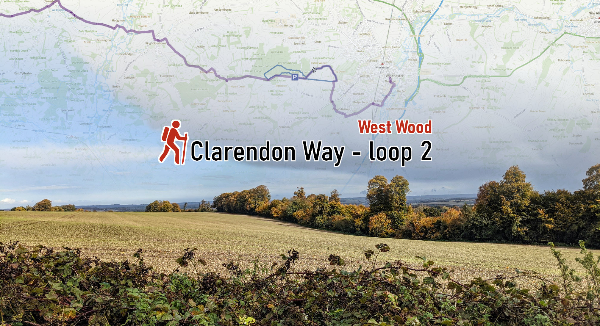
Clarendon Way loop 2 – West Wood
The second loop on the Clarendon Way leads to West Wood. You can either start near Sarum Farm or fro…
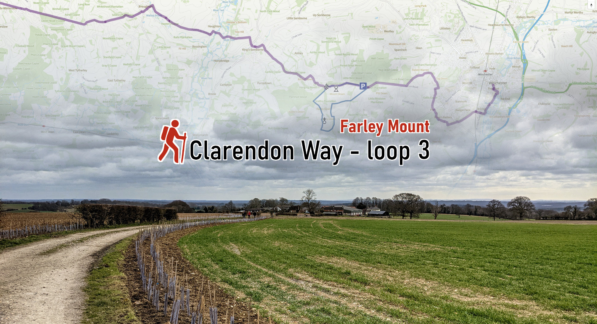
Clarendon Way loop 3 – Farley Mount
Farley Mount is being circumnavigated on our third loop walk on the Clarendon Way. A popular land ma…
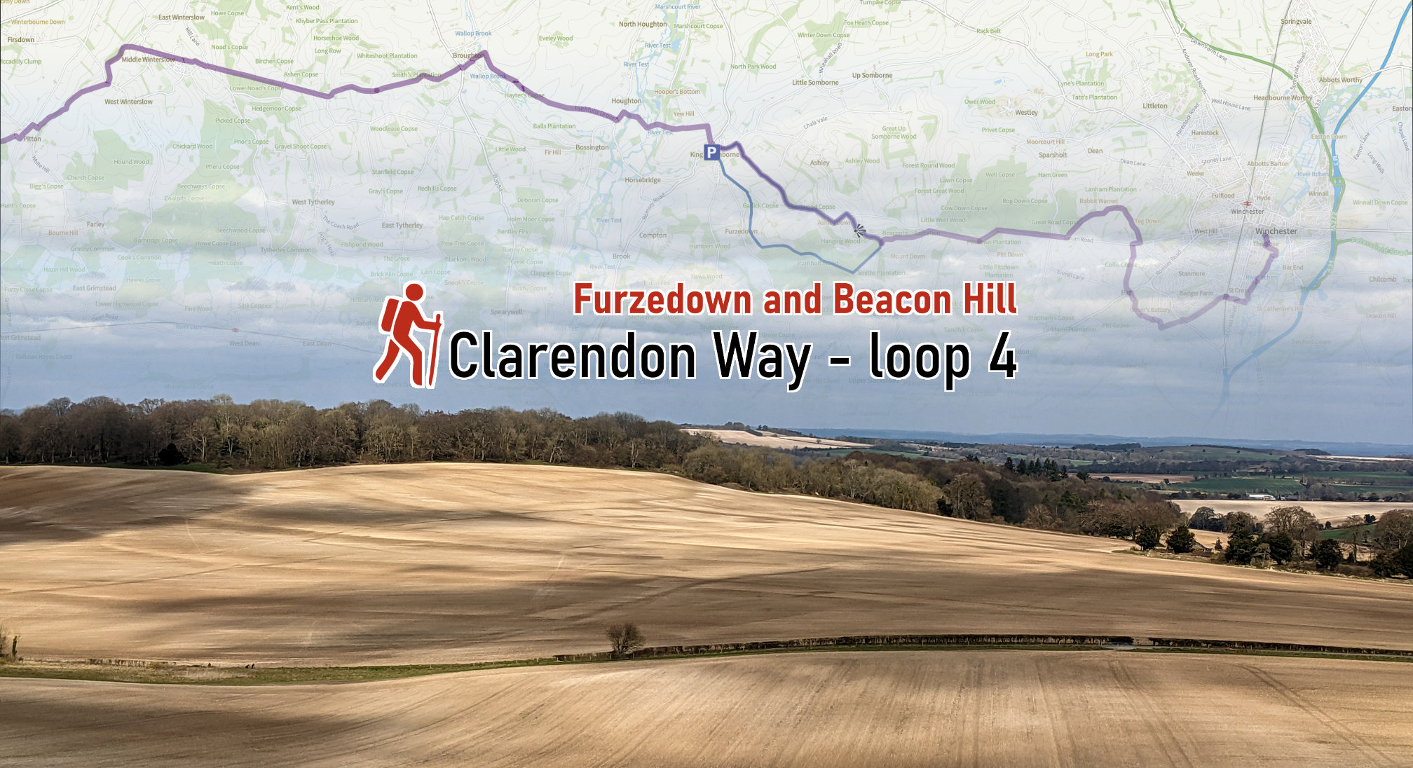
Clarendon Way loop 4 – Furzedown and Beacon Hill
The fantastic view from Beacon Hill over the Hampshire landscape is one of the highlights of this 10…
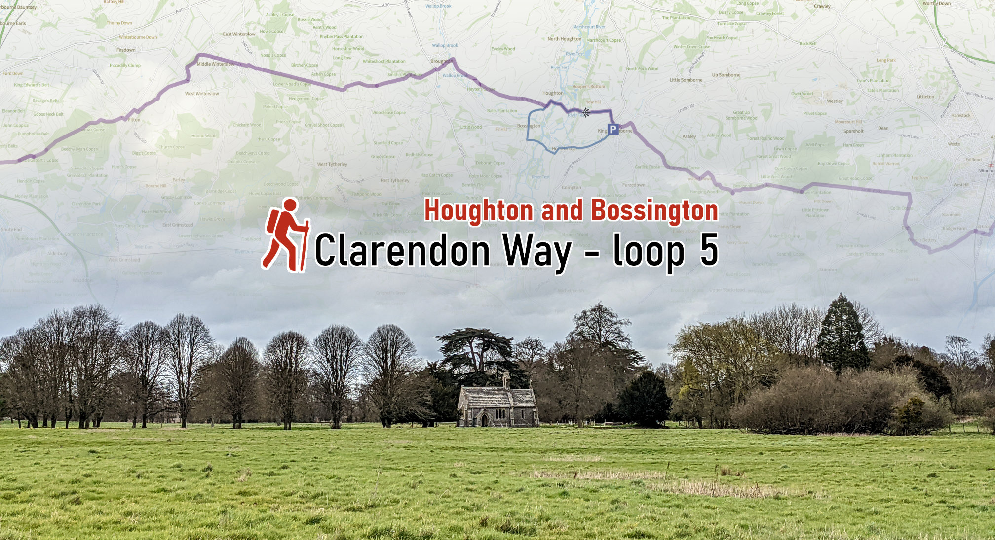
Clarendon Way loop 5 – Houghton and Bossington
The crossing of the River on the Clarendon Way happens the village of Houghton. Our walk loops back …
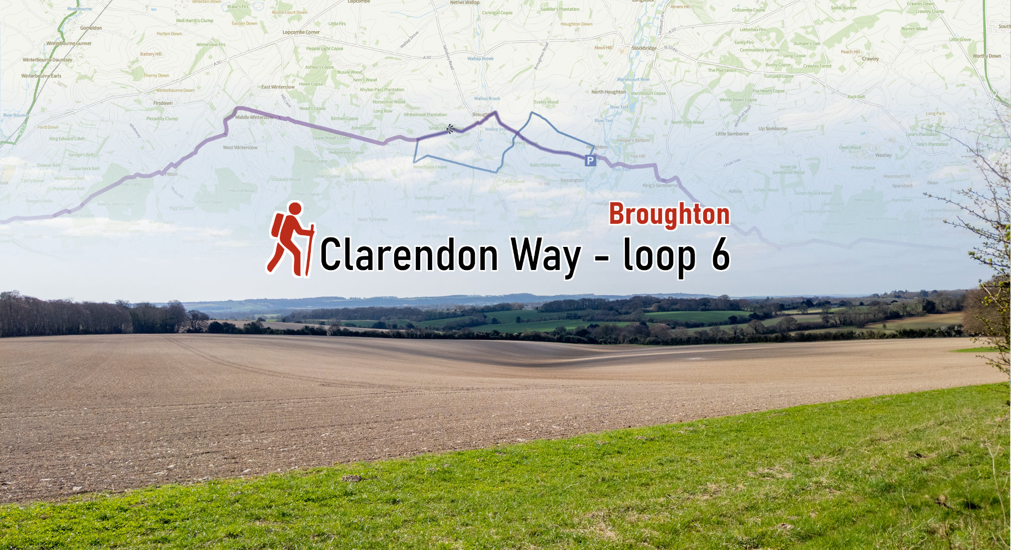
Clarendon Way loop 6 – Broughton
This walk follows the course of a figure 8 from Houghton to Broughton, up to Broughton Down and back…
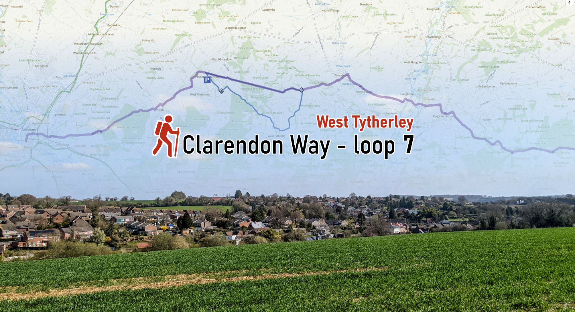
Clarendon Way loop 7 – West Tytherly, Norman Court
This walk starts in Middle Winterslow and explores the countryside to the East leading to West Tythe…
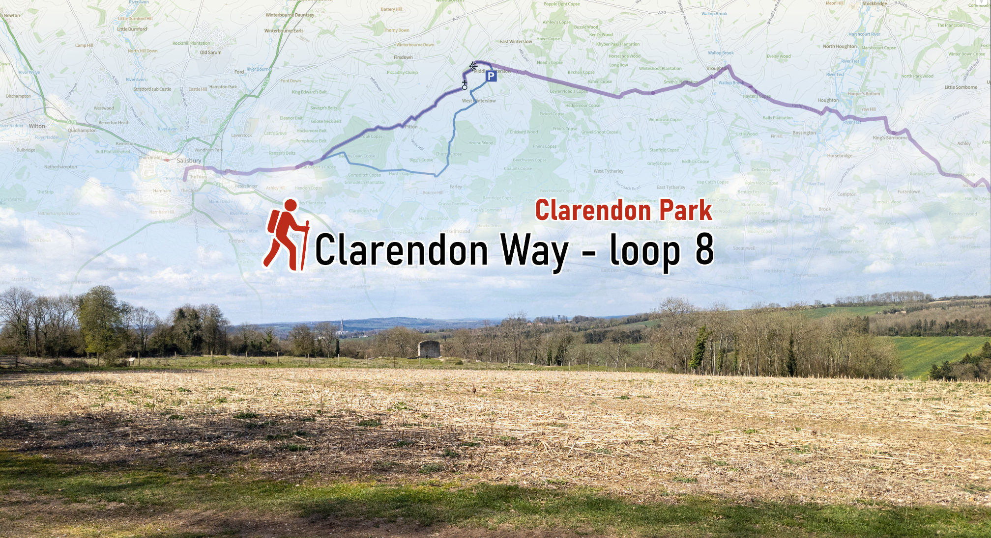
Clarendon Way loop 8 – Clarendon Park
The penultimate stretch towards Salisbury takes us to Clarendon Park, a stone’s throw from Sal…
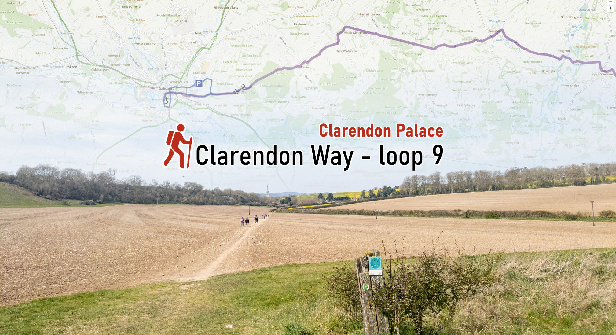
Clarendon Way loop 9 – Clarendon Palace
You might have caught a glimpse of Salisbury Cathedral on loop 8 already. The final stretch on the C…